
An autumn trail run in Sipoonkorpi offers diverse trails, steep climbs and descents, and a reward at the end of the run.
The rain promised for the weekend made us head out to the running trails already on Friday. We chose Sipoonkorpi, where we knew there would be suitable running terrain and fresh air. The starting point was the Kuusijärvi outdoor area, which is easy to reach either by car or public transport. There is a free parking lot on site, which had plenty of space at least on a weekday. The area is popular with outdoor enthusiasts, so space might be limited on weekends.
At Kuusijärvi, there are fitness trails maintained by the city of Vantaa (+ a beach with saunas), and the area has several dog prohibition signs. However, the ban only applies to the lit circular routes near the outdoor center and the beach. The trails and forest roads further away from the area are allowed for dogs.
Our route starts at the outdoor center and quickly moves onto the trails in the so-called "get rid of illusions" section. A steep, root-filled uphill climb rises to the top of a rock and immediately raises your heart rate. However, there's no need to be scared at the start, as most of the route is flat and easy needle-covered trail and forest road. In fact, except for a few steeper climbs and descents, you can keep a steady running pace on the route.

We used a Garmin GPS watch (Forerunner 945) with the route loaded. The route is mostly unmarked, so some map/navigation device is almost essential unless you are already familiar with the area's trails. The route is mostly wide and clearly well-traveled, so getting lost is difficult, but it’s handy to check a few intersections on the map.
The route has several rest spots with fireplaces, and when going clockwise, early on you encounter a rare sight in Southern Finland: a large white kota. This is apparently free to use, and inside there is a fireplace and seating for at least ten people. We already started planning a trip for early winter with sausages and hot cocoa.

 There were several stairs along the way, and some had metal grates that were a bit unpleasant for the dog's paws. However, the dog could also walk alongside the stairs if desired.
About a third of the way along the route, the path turns towards Högberget and Kaskenpolttajanpolku, which appear on the map as a smaller loop farthest from the starting point. If you want a shorter run, skipping this section will reduce the route by about 10 km. However, we recommend that extra loop because Kaskenpolttajanpolku was perhaps the nicest part of the route. The trail is mostly winding and well-maintained, a gravel outdoor route that climbs high up Högberget, from where on a clear day you could probably see far over the forest. This time the visibility wasn’t that amazing, but it’s still a nice spot.

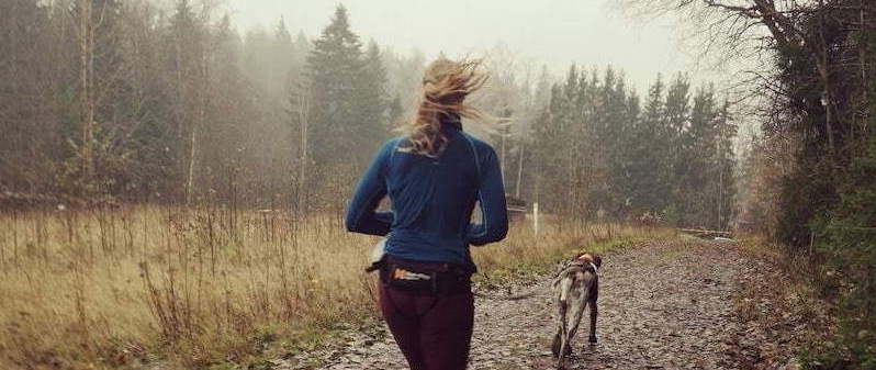
We used Tuija's Non-Stop Canix belt running belt and Utu wore Non-Stop Freemotion harnesses. For trail running, we recommend a longer leash model so there is more space between the dog and the runner, allowing the runner to see the terrain and choose their steps between roots and stones. A good choice is, for example, Non-Stop Bungee leash the version that stretches up to 2.8 meters.
Garmin track: click the title Kuusijärvi-kalkinpolttaja on the map below.
You can download the GPX file from Garmin's website by clicking the three dots next to the Share button.